
Walk the Webb County Street Directory
A street-by-street search is strongest when it begins with one complete address and preserves the original spelling, direction, street type, ZIP, city label, and date. Postal delivery and civic jurisdiction are separate questions in Webb County. Use the USPS ZIP Lookup to normalize delivery information, then compare the location with county or city maps before sending a request to a city office or county office. A postal result does not confirm that a named person or company is at the address.
The next records are property-centered. A tax result can identify an account and a situs address, while an appraisal record can supply a property identifier and legal description. The Clerk index then connects names to recorded instruments. A directory entry or permitted voter record may provide a dated lead, but neither turns a property record into a complete household list. This Webb County street directory therefore keeps the source type and its date beside each conclusion.
- Enter the address in the Tax Assessor-Collector search, first by street number and street name or by account number if it is already known.
- Save the situs address, account reference, tax year, and legal-description clues. Keep a mailing address in its own column.
- Use the legal description, subdivision, lot, block, or party name in the Clerk index to locate the recorded deed or plat.
- Compare the block with official county and city map material for jurisdiction, city-limit, ETJ, road, subdivision, or historic-context questions.
- For a dated household clue, ask the library for the relevant directory street section. Use Texas voter tools only through the permitted official route and respect confidential records.
That sequence works from an address to records, not from a guess about who lives there. It also leaves room for older maps or directories when the question concerns a former address rather than a present-day connection.
Webb County Street Search Fields
The Webb County Tax Assessor-Collector documents owner-name, property-address, and account or billing-number routes. Address searching separates the street or PO number from the street name. If the situs address does not find a result, the county instructions say a mailing-address search may help. That is a useful locate step, not evidence of occupancy or recorded title.
| Tax search label | How to use it | Research caution |
|---|---|---|
| Search Name, Last then First | Use an owner surname followed by the given name. | An owner label is not a complete household roster. |
| Owner Last Name / First Name | Use the advanced alternatives when the name is known. | Check spelling variants before treating matches as one person. |
| Property Address, Street/PO # | Enter the number separately from the street name. | Keep the original address form for comparison. |
| Property Address, Street Name | Use a distinctive street name to narrow a by-address search. | Portal result limits were not documented in the reviewed material. |
| Account/Billing # | Use the exact identifier when it is available from a bill or record. | Do not publish a full account number unnecessarily. |
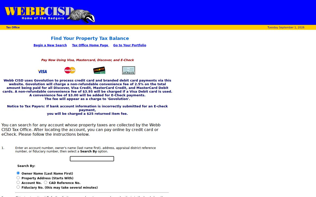
The separate Webb CISD ACT tax search displays search options for account number, owner name, property address starts-with, CAD reference, and fiduciary number. Its examples demonstrate the field style, but it covers accounts whose taxes are collected by Webb CISD. Treat it as a collector-specific source rather than a universal Webb County street directory.
Use the results page as a record inventory. It may offer an account number, owner label, tax detail, bill or receipt, tax year, payment information, taxing entities, exemption indicators, and CAD references. Those fields should be copied as fields, not blended into a claim about residence.
The Webb CISD ACT tax search shows the address, owner, account, and CAD-reference paths used for eligible collector accounts.
Webb County Street Record Coverage
Different custodians answer different address questions. The records below form the usable core of a Webb County street directory. Some are live searches, some are map pages or staff-mediated requests, and some are historic collections. A source can establish only the field it holds.
| Address record | Custodian | Street-level value | Access and boundary |
|---|---|---|---|
| Tax account | Tax Assessor-Collector | Account, situs and mailing address, owner label, tax, exemption, and payment fields | Online search; it is not a title or occupancy record. |
| Appraisal data | Webb CAD | Property or GEIO ID, legal description, classification, value, and map references | eNotice fields verified; live public search controls were not captured. |
| Deed and plat index | County Clerk / TexasFile | Parties, date, instrument, volume or page, lot, block, and legal description | Free index; images or certified copies may cost. |
| County and city maps | Planning/GIS and City services | Boundaries, roads, subdivision, zoning, flood, city limits, and ETJ context | Official pages and PDFs; no verified live adjacent-parcel viewer. |
| Permits or code records | Laredo departments | Address-keyed project, nuisance, or citation event if releasable | Department or public-information request; no public fielded index located. |
| Historic directories | Laredo Public Library / archives | Dated household, business, telephone, or street-page clue | Reference assistance and collection rules apply; exact reverse runs were not located. |
For registered-voter information, a personal status lookup is not a bulk street roll. The official state route and public-list procedures are regulated. Confidential voters, protected addresses, and identification numbers remain protected, and the statute restricts commercial or promotional use of furnished lists. A daily voted list records limited participation information for a prior day, not every household on a street.
Webb County Address Systems Compared
Tax, appraisal, recording, and map systems should be reconciled, not merged. The tax portal handles billing and payment records. Webb CAD is the appraisal source. The County Clerk holds recorded instruments. County and City OpenGIS material supplies geographic context. A different owner label, date, value, or address across those systems can reflect their separate purposes rather than an error.
| Source family | Best use | What it cannot settle alone |
|---|---|---|
| Tax account | Find a billing account, situs, tax year, and collector fields. | Recorded ownership or present occupancy. |
| CAD appraisal record | Bridge a property ID, legal description, classification, and map reference. | A complete title chain. |
| Clerk instrument index | Find the deed, plat, lien, release, or notice by party and legal description. | The full terms without reading the image. |
| County or City map | Check city limits, ETJ, precinct, subdivision, zoning, or flood context. | Who occupies a parcel. |
This comparison is especially useful where a mailing address differs from the situs. A homestead indicator may support an owner-occupancy inference, but it is not conclusive. Keep mailing address, situs, legal description, account, property ID, instrument number, and record date in separate fields.
Webb County Deeds by Street
The TexasFile Webb County Clerk Records index supports first name, last name, business name, instrument number, volume, page, and legal-description searching. Its legal-description builder includes subdivision, lot, block, tract, survey name, abstract, and free-form fields. Search by the address-derived legal description when a name is common.
A deed chain starts by finding the likely purchase instrument for the tax or CAD owner, reading the grantor and grantee, then looking for the seller as a grantee in an earlier transaction. Read the image before making a conclusion about the parcel. The image can contain the legal description, execution and acknowledgment, prior references, restrictions, releases, liens, and redactions that an index row cannot fully convey.
The TexasFile Webb County deed index illustrates the grantor, grantee, instrument, and legal-description route.
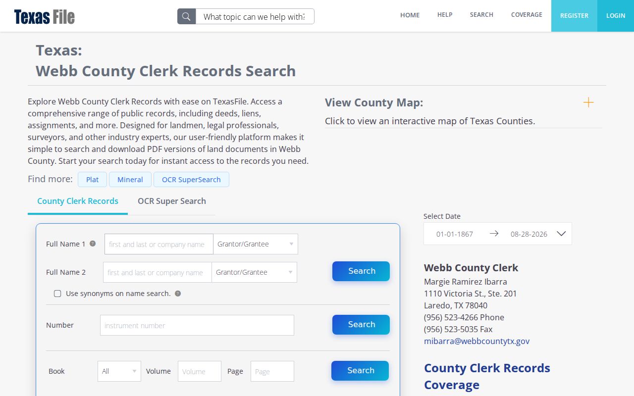
The portal displayed full-index coverage beginning in 1867, while the TSLAC Webb County guide identifies deed records beginning in 1848. For an earlier chain, use the county volumes, archival microfilm, a depository, or an appropriate researcher request. The online cutoff is a planning limit, not proof that older deeds do not exist.
Webb County Street Maps and Plats
A recorded plat connects a subdivision name and lot or block number to a mapped parcel. Compare it with the deed legal description and tax or CAD identifiers. For map context, the county GIS map collection publishes general-information maps for boundaries, precincts, roads, flood studies, facilities, and subdivision material. City of Laredo services lists OpenGIS layers for cadastral, zoning, flood, political, city-limit, annexation, and ETJ context.
Those official materials are useful geography aids. They do not document a verified public parcel viewer with live owner details, click-select controls, adjacent-parcel behavior, or a buffer tool. Do not promise an adjacent-parcel search that the reviewed official pages did not show. Where the plat or map leaves a boundary-sensitive question unresolved, a recorded plat, deed, survey, or current confirmation from the proper office is the safer next step.
Historic street work can also use Sanborn fire-insurance sheets. They show building footprints, material or use, adjacent structures, block orientation, and period street context. They do not establish title or a current resident.
Webb County Address Follow-Up
Some street questions concern an event rather than ownership. Laredo Building and Development Services routes covered work through ProjectDox or its permit email channel. The reviewed city pages did not expose a public address-search field inventory. A focused request can identify the street address, parcel or legal description, permit number, approximate date, and owner or applicant fields if releasable.
Laredo Code Enforcement handles nuisance categories and citations, but no public case lookup was located in the reviewed material. The department or the City public-information channel is the route for an existing address record. A permit, code case, foreclosure posting, or tax-sale notice is an event lead. It does not establish completed work, a sale, present ownership, or occupancy.
Note: Record the custodian, request date, and address form used so a later result can be checked against the same property.
Webb County Street Terms
Address records use terms that look interchangeable but answer different questions. Keeping these distinctions straight prevents an address search from turning a property clue into a claim about a household.
- Parcel
- A defined piece of property tracked through a tax or appraisal identifier and legal description.
- Situs address
- The taxable property location, distinct from the mailing address used for notices.
- Plat
- A recorded map that lays out a subdivision, lots, blocks, streets, easements, or related boundaries.
- Legal description
- The lot, block, tract, survey, abstract, or other property description used in recorded instruments.
- Criss-cross directory
- An address or street-arranged directory that may offer a dated household or business clue; a verified local run was not located.
Webb County Street Geography
Webb County includes Laredo, Rio Bravo, El Cenizo, Bruni, Mirando, Oilton, and rural or unincorporated areas. A Laredo postal city can differ from an incorporated-city or ETJ designation. The county maps include Laredo corporate limits and the five-mile ETJ, while city layers address municipal boundaries and annexation context. Verify the jurisdiction before treating a city permit, municipal court, or county office as the right records custodian.
ZIP codes add delivery context, not a neighborhood line. USPS says ZIP boundaries do not necessarily follow city boundaries, and Census ZCTAs are generalized statistical areas rather than USPS delivery routes. Use the exact-address USPS result together with the county or city map, tax situs, and recorded property description.
Webb County Street Directory Limits
A Webb County street directory cannot show every occupant, renter, household member, utility subscriber, delivery recipient, or protected voter. A tax owner label, mailing address, homestead flag, deed-index hit, and voter entry each have a different meaning. They should never be combined into an assertion that someone currently lives at a particular property.
Texas voter data has confidentiality and suppression rules. Social Security numbers, Texas driver-license or DPS identification numbers, and protected address or contact fields are confidential in the relevant contexts. The County Clerk also describes a 2025 HB 4350 notice allowing eligible protected individuals to request redaction of certain personally identifying information and residential addresses from public property records. Respect those limits and use source-specific language such as indexed, filed, listed, or mailed.
Lawful use. Use Webb County address records for personal, lawful research and civic or family-history questions. Do not use a record trail to stalk, harass, intimidate, impersonate, or endanger anyone.
Webb County Street Records Over Time
Older address research needs a timeline. Webb County was created in 1848, and TSLAC identifies tax rolls beginning in 1851, deed records from 1848, and later local directory entries for Laredo. Modern portals cover selected data, not every volume or image. Before paying for a copy, check whether an index, a library directory, a map, or an archival reel reaches the date needed.
One practical quirk is the County Clerk fee record: the current web fee page and a 2025 public fee PDF showed different amounts for selected recording and marriage items. Verify the current amount, accepted payment, and office hours with the custodian before submitting a request. The reviewed County Clerk pages also showed differing office-hour information, so calling first is prudent.
For historical street pages, the Luciano Guajardo Historical Collection at Laredo Public Library is reference-only and staff mediated. Ask for a specific directory year, street or address section, surname variants, map date, and reproduction rules. Historical listings are dated snapshots, not proof of a present connection.